Cumulative Impact
The Sea Link project in Kent involves several key elements:
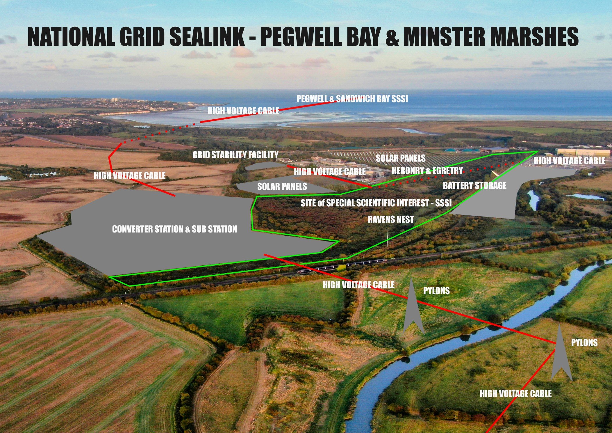
Landfall at Pegwell Bay: The subsea cable would come ashore at this internationally recognized National Nature Reserve, requiring underground cabling to transition to onshore infrastructure.
Converter Station and Substation near Minster: A large converter station (up to 28 meters high, covering about 9 hectares) with an adjacent substation are proposed south of Minster, along with approximately 3.5 km of new overhead high-voltage lines connecting to the existing Richborough-to-Canterbury line.
Construction Activities: Temporary compounds, access routes, temporary and permanent roads and archeological digs.
These components don’t exist in isolation—they add to an already pressured landscape with existing infrastructure and past projects, like the Nemo Link cable installed in 2018, which left lasting ecological scars on both the River Stour and Pegwell Bay.
The converter station would dominate the flat, open landscape alongside new pylons. When added to existing infrastructure, this could create a visually intrusive industrial cluster, eroding the area’s rural character and biodiversity, the very thing that we are aiming to protect.
The cumulative impact in Kent appears to stem from a planning approach prioritizing cost and expediency over ecological and social sustainability. The focus on Pegwell Bay and Minster, rather than offshore pooling or brownfield sites, suggests a pattern of overburdening environmentally sensitive areas. This raises questions about whether National Grid’s profit motives (e.g., leveraging Richborough for European exports) outweigh the public interest in preserving Kent’s natural heritage—a tension not fully resolved by current proposals.